Waymo and Waze are teaming up to combine their road data in a pilot program across five cities. The goal? To help cities identify and fix potholes faster than ever.
These two Google-affiliated companies are merging their insights on street conditions. Waymo brings data from its fleet of self-driving robotaxis, while Waze taps into information from its hundreds of millions of crowdsourced navigation users. Together, they’re creating a clearer picture of where roads need attention. This data will go straight to city transportation departments, allowing repair crews to tackle problem areas more quickly.
How the Partnership Works
Here’s how it breaks down: Waze acts like a neighborhood watch for roads. When drivers hit a pothole and report it through the app, that information gets logged and shared. But human reporting can be hit or miss. Sometimes people forget to report an issue, are in a rush, or just don’t bother.
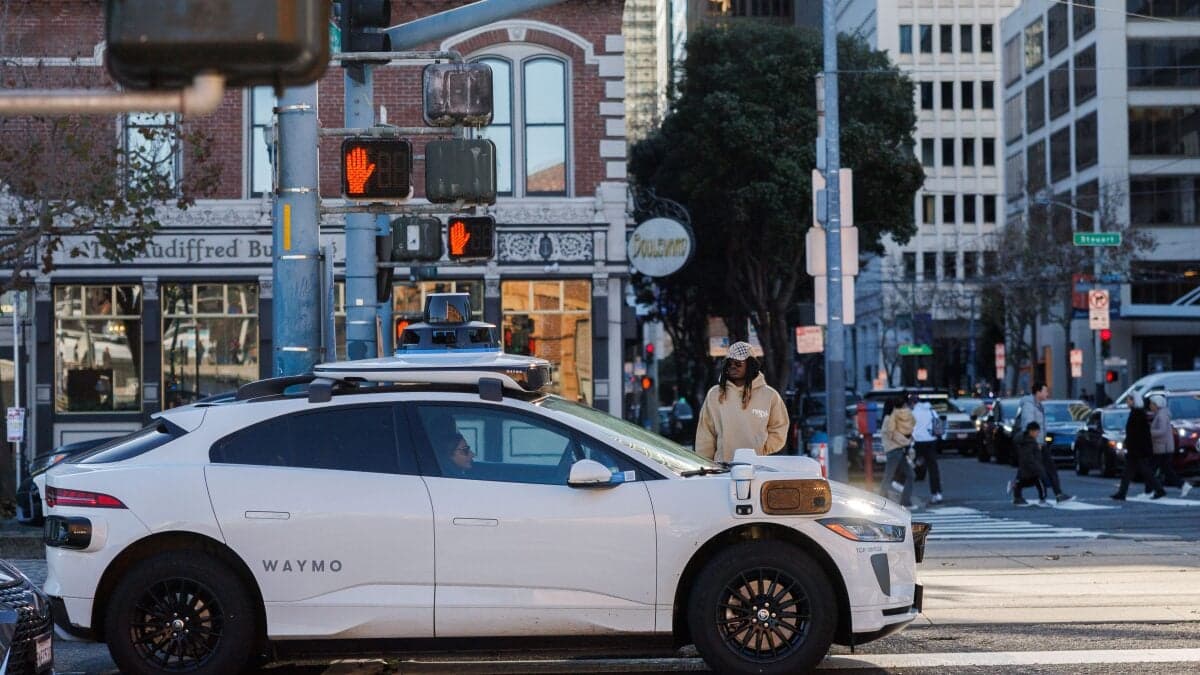
That’s where Waymo’s self-driving cars come in. These vehicles function as rolling sensor platforms, equipped with cameras, lidar — a radar-like system that uses laser pulses to map the surroundings — and other tools. They continuously scan road surfaces, recording every bump, dip, and crack, whether or not someone reports it.
By combining these data streams, city planners gain access to something new: a consistent, high-frequency map of road damage that updates almost in real-time. This beats relying on annual inspections or calls from frustrated residents.
Why Potholes Are a Bigger Deal Than They Seem
Potholes aren’t just annoying; they’re costly. The American Automobile Association estimates that potholes cost U.S. drivers around $3 billion each year in vehicle damage, including blown tires, bent rims, and damaged suspensions. Cities also spend billions more trying to fix roads that inspectors might miss before small cracks develop into big craters.
Typically, the approach to pothole management is reactive: a resident calls 311, a crew gets sent out weeks later, and by then, the damage might have worsened. A data-driven system that identifies deteriorating road segments before they become major hazards could let cities perform preventive maintenance. This is much cheaper than making emergency repairs.
The Five-City Pilot
Waymo and Waze haven’t revealed all five cities involved in the pilot yet. The program is a test run, allowing them to see how useful the combined data is for municipal road crews before expanding further. The participating city transportation departments will receive regular reports highlighting spots with the most reported road damage.
| Metric | Figure |
|---|---|
| Cities in pilot program | 5 |
| Annual U.S. driver cost from pothole damage (AAA estimate) | ~$3 billion |
| Waze monthly active users (reported) | ~150 million |
| Waymo weekly ride count (as of early 2025) | ~200,000+ |
What This Means for Everyday Drivers
If you live in one of the pilot cities, you can expect a straightforward benefit: fewer potholes for longer periods. Roads that are flagged early can be repaired before they cause issues like blown tires or suspension damage.
For Waze users, this partnership could eventually enhance the app itself, providing more accurate and timely road hazard warnings. Plus, riders in Waymo’s self-driving cars will enjoy smoother rides on roads that are better maintained, thanks to precise sensor readings.
Looking ahead, this model hints at a future where city infrastructure maintenance is driven by real-world driving data instead of resident complaints or scheduled inspections. This shift could stretch municipal road budgets further and reduce the number of emergency repairs that disrupt traffic.
Community Reactions
“Finally a use for all that surveillance data that actually benefits the people being surveilled. More of this please.”
“Cool idea but I’ll believe it when my street actually gets fixed. Cities get all kinds of data and still take 6 months to patch a hole.”
A Note on the Data
Waymo and Waze are both under Alphabet, Google’s parent company, which makes sharing data easier than in most cross-company partnerships. Critics have raised concerns about the amount of location and road data these platforms collect. However, both companies assure that the road condition data shared with cities is aggregated and doesn’t include personally identifiable information about individual drivers or passengers.
For more details on the partnership, check out the original reporting from CNET and Mashable.
What To Watch
- Pilot city announcements: Waymo and Waze plan to announce the five cities involved as the program kicks off. Keep an eye out for local transportation department press releases confirming participation.
- Pilot results: The companies haven’t set a specific end date for the trial, but infrastructure pilot programs usually last six to twelve months before results are shared. Pay attention to road repair response times in these pilot cities.
- Expansion decisions: If the pilot shows improved pothole response times, both companies are eager to scale the program. Waymo’s expansion into new cities would naturally broaden the reach of any follow-up program.
- Competitor moves: Apple’s rumored mapping enhancements and autonomous vehicle data initiatives could push competitors to form similar municipal data partnerships. This space is likely to become more crowded quickly.
Maya Torres
Maya Torres is the Consumer Tech Editor at Explosion.com with 7 years covering product launches for major technology publications. She has reviewed over 300 devices across smartphones, laptops, wearables, and smart home products. Maya specializes in translating spec sheets into real-world buying advice and attends CES, MWC, and Apple keynotes as press. Her reviews focus on helping readers decide what to buy, not just what specs look good on paper.